"I envied a raven as he flew into the late afternoon light over reflection canyon. I called out to him in a loud voice that echoed through the canyon, "hey buddy!" It felt good to say that. "How does it feel to be free?" But he never responded. And it was better that way."

Reflection Canyon glowing in the afternoon light
WHAT TO EXPECT
Gorgeous colors and winding channels of water cut into the high cliffs of Lake Powell. Be prepared to drive a fifty-one mile dirt road followed by a rigorous, one-way 6-10 mile hike that will demand your best route-finding skills and use of a good map or GPS. Water levels and temperatures are lowest in the Spring, which is an ideal time to make this adventure.
HOW TO GET THERE
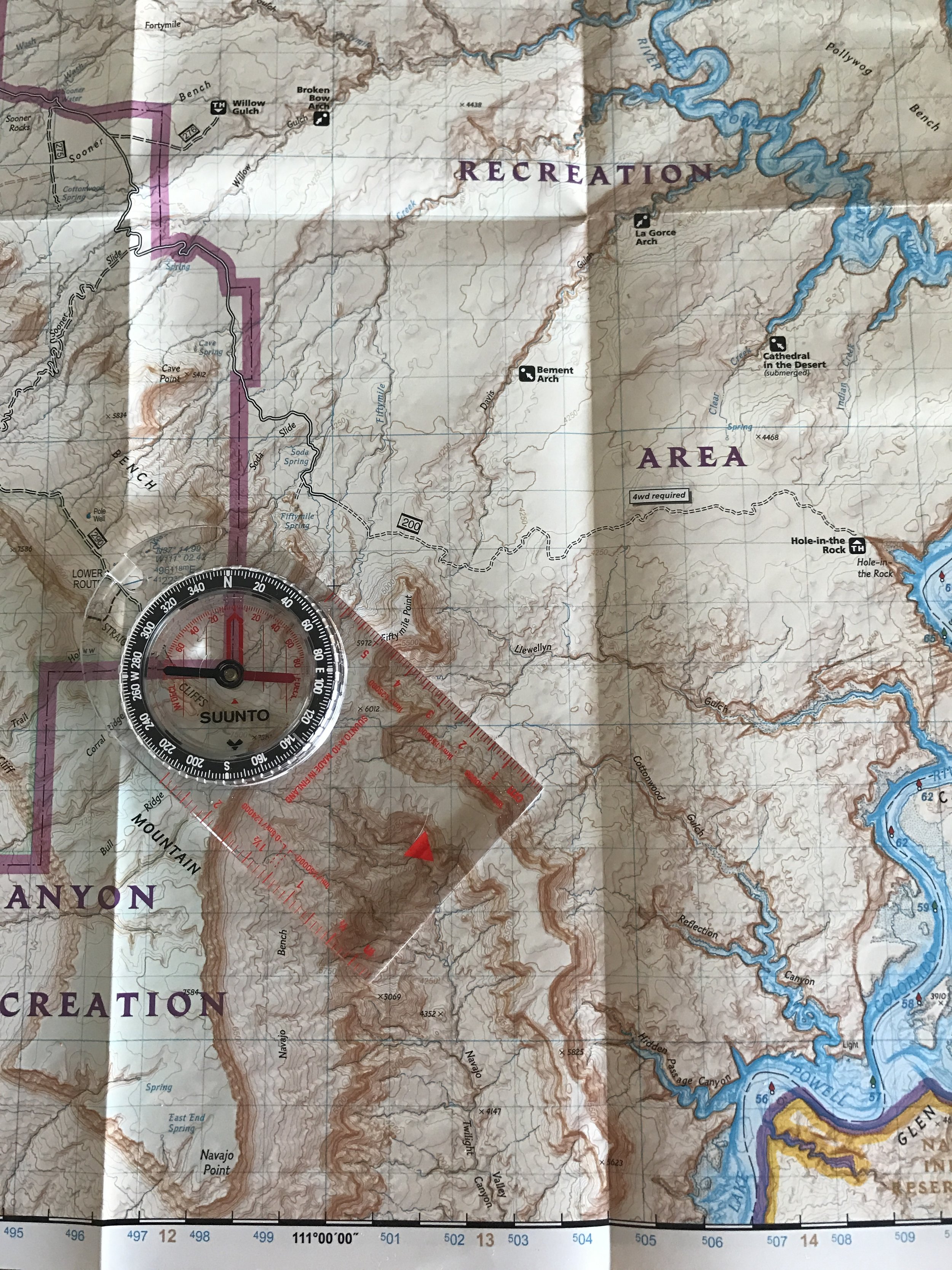
Map and compass is a great way to navigate. I picked up this map of the Escalante National Monument for $13 at REI. Well worth it!
From Escalante go five miles east to Hole in the Rock Road. Travel exactly fifty-one miles south on a washboard dirt road. A four-wheel drive, high clearance vehicle is needed. After you've parked start hiking south, hugging the large cliffs to the west. This will help you avoid a multitude of ravines and slots canyons that wind throughout the landscape. After a few miles you will begin heading southeast over rocky hills and ankle high prickly pear cactus to reach Reflection Canyon. There is no right way although some ways are more direct. A more direct route may mean traversing up and down large hills. Do your best to avoid too much up and down travel using the landscape to your advantage.
BE PREPARED! Remember that this is a rigorous hike into the wilderness. There are rarely any trail markers (cairns) and footprints are not always a reliable source of direction. Do your research before. Bring a map and compass. Bring a GPS, or if you dont feel like spending the several hundred dollars for a decent one, map out your course on Google Maps on your phone. When Navajo Mountain is in sight (to the south) you should get cell phone coverage (I received LTE for Verizon). and be able see your progress via Google Maps. It may seem obvious but by using your natural landmarks you will be able to navigate your course. See images below.

I was able to use Google Maps to create a saved location. The heart is Reflection Canyon and the blue dot with arrow at the top left corner is where I parked my car. When I had service I could check my progress to make sure I was headed the right way. Make sure to use Google Earth for a more detailed map of the area.

Parked car at the "trailhead." Follow these cliffs to the south as you make your way to Reflection Canyon.
WHAT TO PACK
Reflection Canyon can be done in one day. One long day. But for however many days you do plan to come make sure to bring one gallon of water per day. I would also recommend something like Gatorade to help replenish electrolytes. Plan meals accordingly. I am a big fan of Backpacker Pantry prepackaged meals that just need hot water. Snacks are a must as well - trail mix, protein bars, etc. Whatever you pack, make sure to use Leave No Trace principles. There are no bathrooms along the route.
WHEN YOU GET THERE

Camping is possible along Reflection Canyon although there are few spots to pitch a tent. Take great care along the cliff ledges as you will be only a few feet away from several hundred feet drop-offs. And as always, make sure to practice Leave No Trace principles. Happy Camping!
After a challenging hike, reward yourself by making camp and wandering the tall cliff edges to gain the different and spectacular views of Reflection Canyon. Following the canyon edge north will take you several other stunning views.
As far as photography, I found the best success during the afternoon light before the shadows set in. The best shots were at dusk when the canyon turned to from gold to blue and back to gold. Make sure to also take advantage of the early morning light just before the sun rises over the distant cliffs. If you are lucky enough to catch a full moon you will be delightfully surprised by the glow of the canyon walls in the moonlight, especially on the white-stained places of the rock where the high water level once was.